The islands are full of socially-distanced activities to enjoy – and there’s no better way to experience the BVI than with one of the wonderful hike trails from Trails & Tales: The British Virgin Islands Hiking Guide by Ron Beard
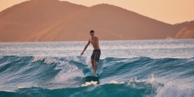
After a year like no one has ever experienced, the world has changed. Now more than ever, we are searching for fun activities to enjoy that are safe. Hiking is the perfect outdoor pursuit that keeps you and your family fit, while staying socially distanced and taking in some of that fresh BVI air.
A great way to see more of these beautiful islands is to pull on some sturdy hiking shoes, grab your sunscreen, a snack and some water and get outside to take in the breathtaking surroundings (not to mention incredible views!).
Mount Alma & Trellis Bay
Height 0 – 700 ft
Distance 3.2 miles
Time 3.5 hours
TYPE Circuit
EFFORT ★★★★
This is a multi-dimensional walk through the innards of Beef Island with a wide variety of environments and challenges. These include a bush section, a trek up Mount Alma, a wander round Banana Wharf salt pond, rugged coastal strip and the peaceful postcard-pretty Trellis Bay, with a soft return through a miniature African-like savannah land.

 Trail Directions
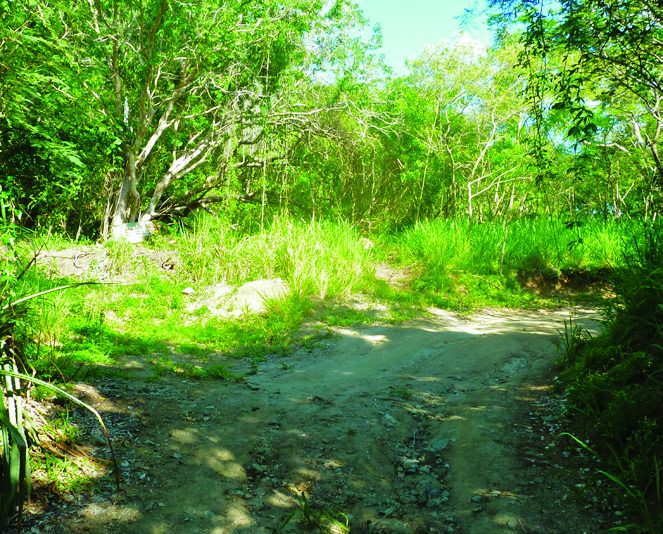
Head to Beef Island and after crossing the QE II bridge, pass the junction to the airport terminal on your left. Some 200yds ahead, where the main road bends left at the telecoms tower, turn right and then immediately left. Follow the old and poorly surfaced road looking out for the second dirt track on the left and park, sensibly, near this junction (Waypoint on the map). This is the start of the walk. Note that this track may now be gated to dissuade vehicular traffic, but you can still pass by foot.
Follow the muddy track in a generally NE direction as it cuts through the scrub forest and, in 150yds, look out for a small more open area on the left previously used for informal parking, While the track bends right, up towards a couple of cabins, do not follow it. Rather, hunt around the left edge of the open area looking for a rather indistinct trail through the uninviting undergrowth.
From here, the next 70yds can be a bit of a pain as the level trail makes its way in a NE direction through an abundance of aloes with thick splayed leaves and pinguin bromeliads tinged with red and sharp, prickly points waiting to pierce your shins. Persevere with care and poles (or machete, if one is to hand) and after a few minutes you’re through the worst.
The trail is much clearer now and it’s a pleasant wander along this historic path under the forest canopy where there is still evidence of its earlier role as an important cattle-driving route through the middle of the island. In places it seems to run in the bed of seasonal streams with large boulders all but barring the way, but keep heading NE and you won’t go far wrong.
However, even at this early point, little more than 350yds from the start, you have a choice: either follow the main trail towards the N coast of Beef Island . . . or, take the recommended Side Trip to the top of Mount Alma in a SE direction (described below).
 Side Trip to Mount Alma
(Shown in red on the trail map) Conceivably this could be a short but semi-strenuous hike in its own right, up the well hidden access trail, summiting and then retracing your steps back along the inward route to the start, having taken 1.5-2hrs depending on time at the top. However, since it is a comparatively short distance (a round trip of about 1.5mi), with a net addition of little more than one hour plus rests, it is included in the main walk as a ‘must do’ Side Trip.
The first challenge, however, is to find the starting point (it took me three failed attempts to locate the trail). You are looking for a well concealed path at right angles to the main trail, about 350yds from the prickly pinguins. You’ll need to search for a small cairn (pile of rocks) on the main trail. Opposite this, on the right, look out for route markers in the form of small, colored ribbons and /or plastic ties attached to tree trunks and branches at eye level. Follow these ribbons. After the first success, you’ll quickly become accustomed to the art of ‘ribbon spotting’.
The trail wends its way slowly upwards, zig-zagging here and there, carefully avoiding the biggest of the boulders and steepest sections. This is hardly surprising since the trail is used by the BVI Airports Authority who look after the aeronautical navigational beacons that assist pilots using Terrance B. Lettsome International Airport, the Territory’s main gateway. Indeed, you will see the focus of their attentions perched on top of the hill.
The predominant vegetation here is dry forest with the ubiquitous turpentine and loblolly trees contorting themselves around rocks and each other in sinuous, amorous embraces. Mourning doves, identified by their mournful four-note repetitive calls, and the high-pitched ‘kiss-kiss’ of the bananaquits, define the character of the friendly forest and this makes the journey that much more pleasurable. For the most part the trail is easily followed, but a keen eye for the sometimes well-concealed ribbon markers remains essential. There are one or two notable sections where the line of sight stretches ahead 30yds or more and it is in those sections that sightings of bright lemon yellow sulphurs and gulf fritillary butterflies, large ground lizards with turquoise tummies and running rodents are most likely, so stay alert.
After some twisting, steep and strenuous sections, you will sense more daylight above and the emergence of more rock outcrops and boulder formations below. While still some way to go under the thinning canopy you’ll eventually be tossed up quite suddenly upon the steep, rocky approach to the top. Be persistent and find a suitably safe route to the summit, which reaches over 730ft above sea level. Find a solid nesting perch atop the rocks before taking in the stunning views, for if you don’t, the scale and perspective of the scenery below may mesmerize you momentarily and upset your internal gyroscope.
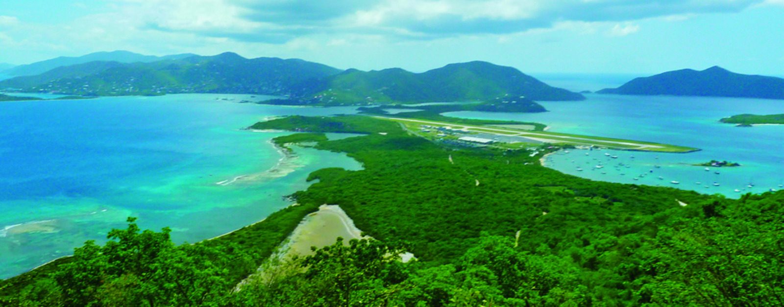
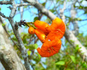 The 360-degree panorama from the top is spectacular and might be described as one of the best views in the BVI. Looking W, the foreground is taken up by the bountiful Geiger tree seasonally heavy with its deep-orange flowers; the middle distance is dominated by the incongruous billiard table flats of the airport runway with the slender bridge beyond, an umbilical cord tying Beef Island to the magnificently mountainous profile of Tortola.
With views W to Tortola, N to Scrub, the Camanoes and Guana Islands, E to Virgin Gorda (concealing all its North Sound relatives beyond) and the energetic southern sweep of islands bordering Drake’s Channel, the whole scene is worth a prolonged “WOWWEEE!,” thereby entirely justifying the effort expended. The chaps who regularly service the aeronautical station, immediately E of the summit, have a job that some hikers would truly envy . . . at least for the first few sorties. Must be one of the best views in the Territory!
When the mood takes you, retrace your steps carefully, now in a NW direction, down the same steep trail returning to the path where you turn right, to rejoin the main walk towards the N coast . . . or left, back to the start if time is limited.
 Continuation of Main Walk
Follow the easy path past collections of rocks and trees seemingly sculpted from the pages of a Grimm’s fairy tale and in another 600yds, off to the left and down a shallow slope, you’ll sense the edge of the Banana Wharf Salt Pond. Be patient and ultra quiet over the next section and you’ll find a short route down to the water’s edge where with any luck, you may espy a collection of sandpipers and plovers poking around in the shallows for a snack.
Continue on in broadly the same NE direction through the scrub forest, and the rocky trail will level off and the crusty edge of the pond will reappear. Here you have another choice: either, go straight ahead sticking to the trail which tends right and winds its way E below bulbous turpentine trees and black mangroves; these skirt seasonally ponded areas which are protected by an historic limestone wall constructed parallel to the coast, where you turn left. Or, if you want to see the sea ASAP, follow the trail left past the turpentine trees over calcareous rocks and be guided by a miniature coral cairn some yards ahead.
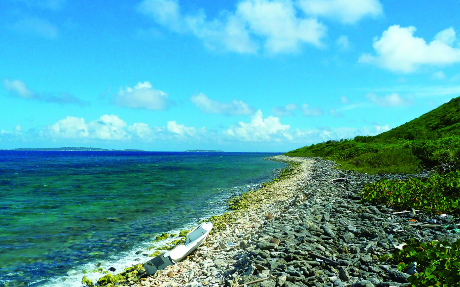
This will bring you from beneath the scrub forest canopy through the allamanda bushes and suddenly onto the rocky shore and into a refreshing onshore breeze. A few more steps and choose your spot atop the coral berm for a 10min breather.
From your vantage point look N and you’ll see the unmistakable Scrub Island Resort. The view E is towards Virgin Gorda with Spanish Town to the right and the magnificent Gorda Peak dominating the centre ground.
The section of the coast you’ve just arrived at is quite exposed and prevailing winds carry all sorts of marine detritus ashore. However, the good people of Trellis Bay are mindful of value and consequently a lot of this paraphernalia, mostly washed overboard from charter yachts, is then regularly harvested and prudently recycled locally. Meander W along the coastline and detour to observe the other side of Banana Wharf Pond. This is surrounded by all sorts of attractive vegetation including wild frangipani with its single white fragrant flowers and the distinctive luscious red berries and rich green leaves of the juvenile gumbo limbo (turpentine) tree, all set against the verdant backdrop of Mt Alma towering above.
 Another 400yds along the coral coast and you’ll approach a substantial rocky headland with a tiny sandy beach in front. The route through the middle section of the rocks (marginally left of the headland) is easy to find and you may even be tempted to enjoy the hammock contraption made from remnants of beach combed fishing nets and slung enticingly between convenient seagrape trees.
Once beyond the headland, the coastal strip becomes even narrower and waves may impede your progress around some of the larger boulders. Follow the coast around, looking out for ruddy turnstones and sandpipers playing chicken with the wavelets. As it slowly turns W along and eventually into Trellis Bay, appreciate the more sheltered waters and the consequential myriad of craft at anchor, scattered across the bay. The beautiful crescent beach extends for almost a mile, offering plenty of opportunities to laze under a palm tree or take a quick, cooling dip.
At this point you’re almost in line with the runway of Beef Island airport, the largest of the Territory’s three and currently the subject of ambitious plans for expansion. At the time of writing, precisely what these may comprise and thus what effect they may have on the environment of the bay, its residents and the profile of the Territory as a whole, was unknown.
About halfway along the beach there is a direct route back to the car; so, if interested look out for the carcass of an old ‘cat’ on the left! Where this decaying catamaran has been hauled just above the high water mark, a small path passes it and leads to a vehicular track. G This runs parallel to, but only 20yds inland from the bay for its entire length. However, our route cuts across it at right angles and continues on a little zig-zag trail due E through the bush for 100yds. At this point the landscape opens out revealing the large and, depending on the time of year, dried up Central Beef Island Salt Pond . Follow the right side of the pan for a further 200yds until you see electricity poles ahead. Immediately below these, turn right and follow the path through the tall, African savannah-like elephant grass for 200yds to a farm track. An interesting little detour off right will take you to several fields won from the bush H . Besides keeping the excellent Beef Island soils tilled and seeds planted, working these fields also involves seasonal watering and hand weeding – all of which effort produces regular harvests of fruit and vegetables such as corn, yams, tannia and dasheen. After this interlude, return to the track and follow it, tending right, 100yds to the old surfaced road on which you arrived. At the junction turn left and another 100yds will bring you back to the start.
Having completed the walk, you may wish to drive into the un-unconventional confection of Trellis Bay and explore it’s rustic charms. Once your field research is over and you’ve definitely decided on your hostelry of choice; order a local brew, sit down, remove the boots, relax, toast the wonders of Beef Island and take a refreshing slug. Congratulations, you’ve made it yet again (this is getting to be a habit)!