Extract from Ron Beard’s Trails & Tales, The British Virgin Islands Hiking Guide
Now we’re certainly not telling you to ‘get lost’ as the phrase ‘take a hike’ is commonly known. Quite the opposite in fact.
If you haven’t heard, Trails & Tales is a guide book to make certain you don’t get lost on the BVI’s most beautiful hikes, and absorb as much of the island’s natural environment as possible.
Author Ron Beard came to the Territory in 2011 on a two-year contract as Deputy and then Acting Chief Planner in the Premier’s Office. After several DIY hikes, he realised that there was no guidance literature on the island for this hobby. After collaboration with aLookingGlass and sponsorship from Sir Richard Branson, Henry Jarecki, Biwater International, VP Bank, and the BVI Tourist Board, Trails & Tales was conceived.
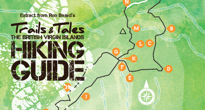
Enjoy this extract of the famous Sage Mountain trail and to see the map referred to in this extract, please click here.
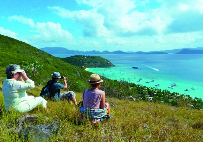
Sage Mountain, Tortola
Summary Stats
| Distance | 3 miles |
| Time | 4 hours |
| Height gain and terrain | Start at 1,300 feet; good track, steep trail, forest paths, branch and wire fences; highest point 1,700 feet |
| Effort required | **** |
| Type of walk | Figure of 8 |
| Nearest watering hole: | Mountain View Restaurant/bar |
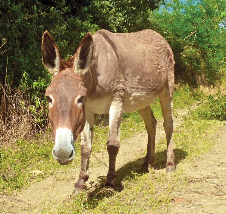
| Warnings: | Be wary of tethered donkeys. On the very last section of the walk, from the side gate of SMNP to the car park, be careful on the adverse camber of the footpath. It can be very slippery when wet. |
Trail Directions
From the Ridge Road driving E to W some 0.5m beyond the Elevator junction, there is a four way cross roads from which the Sage Mountain National Park (SMNP) access and Mountain View Restaurant are signposted straight ahead up the hill. The walk starts from a point some 500 yards uphill beyond this junction, where you should look out for a small access on the left where two dirt tracks join the road from different directions. At this point, there is just room for a single vehicle to park. Note, respect local residents and track users, park courteously or seek a spot elsewhere if necessary. This is the start of the walk (Waypoint A on the Map).
Approach
From here, look S and seaward and start the walk along the level dirt track to your right, being wary of any donkeys that may be tethered!
Follow the track as it tends left below an eerily thick forest canopy and past several ghut beds which, during the season, channel great volumes of runoff from the steep slopes above, down the mountainside below. The track affords access to several houses perched precariously on their plots but enjoying magnificent views over the islands.
Some 300 yards from the start, veer left at a Y junction and follow the now deteriorated dirt track, between its verdant walls. Pass a small wooden hut mouldering back into the forest which is now encroaching on all sides. A further 300 yards ahead on a better section of steeper track, the canopy above begins to open out. Eventually at the corner ahead (B) you’ll be rewarded with a magnificent panorama SE towards Sea Cow’s Bay and Nanny Cay immediately below and across Drake’s Channel.
Continue along and up the track keeping left at a junction, where another track leads up to the right, one supposes towards a future building plot. The walking is an easy plod along the increasingly overgrown track for a further 250 yards past what is becoming rather dryer forest.
Follow the track and as it tends right you may encounter a branch and wire pull-gate strung across it, placed to keep cattle from wandering too far (C). Untie the main branch from its keeper, pass through carefully and re-tie it securely.
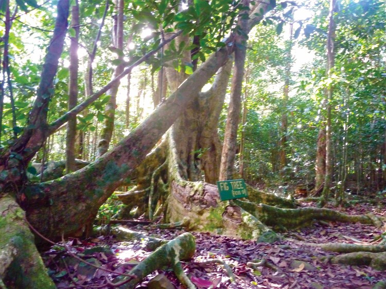
Just beyond the fence look out for the impressive silvery-white nine-fingered leaves of the distinctive trumpet tree above (Cecropia) now scattered on the forest floor below.
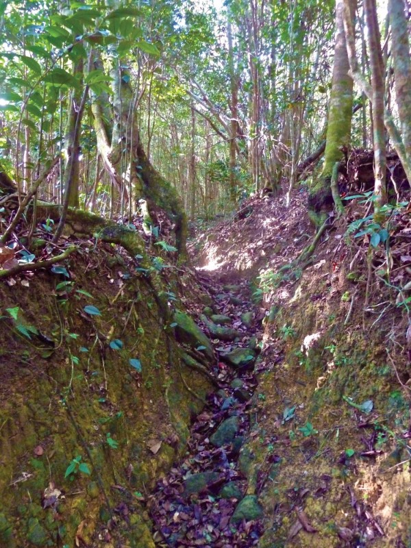
It’s 350 yards up the track to a junction where a small path continues straight ahead and into the dense forest. However, your route follows the vehicular track that turns sharply right and up a very steep section that has been heavily eroded by rains (D). After another 350 yards it levels off and slims down into a narrow path between the forest edges, now enclosed on both sides by barbed wire. Look out on the left for teasing views over the cow pastures below sweeping down towards Havers and Pockwood Pond (E)…
Continue along the main path for a further 250yds and you’ll end up in the bed of a small ghut, barred by another branch and wire pull-gate. However, rather than having to untie it (and another one beyond), swivel right to face a low wire fence and carefully step over it amongst moist scrub forest (F). Walk along the forest edge for 50yds and then step left, back over the remains of the low fence and look for a now obvious and well-worn trail where you tend right. Congratulations, you are now inside SMNP.
Interested in taking a hike?
[ts_fab]