Road Town Harbour Archaeological Project – Since its first European claimant Christopher Columbus in 1493, the Virgin Islands have been a refuge for naval ships and merchant shipping. Deep passages such as Sir Francis Drake’s Channel served as motorways for ships passing through the islands. Ultimately these ships needed to “refuel,” or in historic terms, obtain fresh water, ship stores, and find shelter for protection from weather or enemy ships.
Many of these natural harbours became safe havens for European vessels, and would develop into ports and marine fortifications. Interestingly, these so-called safe havens have revealed dozens of shipwrecks, offering a unique opportunity for archaeological study.
Archaeological investigations were undertaken by the University of Bristol in June 2005 to document the remains of HMS Nymph, a 300-ton sloop of war that burned in Road Town Harbour in 1783. The site, reported following an encounter with a 1969 dredging operation, was, however, not located. Instead, two separate and distinct shipwreck sites were identified and examined. This article will focus on the 2005 survey, detail and assess cultural finds, and illustrate the historical and archaeological significance of both naval and merchant ship remains sunk at Road Town.
Launched at Chatham Dockyard in May 1778, HMS Nymph served King George III’s Navy as a support vessel in both the East and West Indies. Nymph was one of 25 vessels of the Swan class of Royal Navy ships, boasting a length of 96 feet, a beam of 26 feet, and a depth in hold of 12 feet. This 303-ton vessel was built with three masts (ship rigged), and able to carry a complement of 125 men, 16 guns (carriage-mounted cannon), and 14 swivel guns (rail-mounted cannon).
She was first commissioned under Vice Admiral Sir Edward Hughes’ East India fleet in 1779. Her duties included protecting interests in Calcutta, Bombay and Madras, and also serving as an escort to East Indian merchant convoys. In December 1782, HMS Nymph was reassigned to the West Indies under Admiral Hugh Pigot and Rear Admiral Sir Richard Hughes, Lesser Antilles squadron. Her role was to protect English interests and island inhabitants from French and American privateers.
Her Caribbean adventures, however, ended abruptly. On 28 June, just before 11 pm, Nymph was found to be on fire. Aid was sent from shore and from nearby merchant ships, but smoke and flames defeated efforts. The ship was abandoned to burn out, with the loss of three servicemen. At a Court Martial assembled on board His Majesty’s ship Enterprize at Antigua on the 4 August, 1783, fault was owing to the carelessness of the purser’s steward with the cooper’s lights in the steward or slop rooms. Commander Richard Hill, his officers and crew were acquitted from fault of the loss.
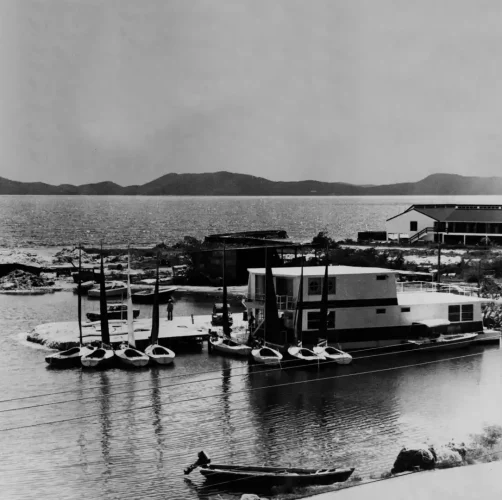
In February 1969, dredging in Road Town Harbour for the Wickham’s Cay Development Authority revealed remains of a shipwreck. Dr. Edward Towle of the Caribbean Research Institute assisted by Mr. Alan Albright undertook examination of the finds exhumed by the dredger. A limited survey of the site was conducted, although inconclusive as to the extent of cultural remains. A total of about 400 artefacts were recovered that included items ranging from galley wares, ordnance, carpentry tools and ship’s equipment. The remains suggested a naval ship, and historical research identified that this “major find” may be HMS Nymph, a naval sloop of war lost in 1783. The collection of artefacts were conserved, documented through drawings and photography and placed in a travelling exhibition.

Regrettably, this irreplaceable time capsule of 18th century shipboard life was “misplaced” by curators, and its location today remains unknown. A photographic archive of these artefacts, donated by Mr. Albright, is now held by the University team. No further study of the site was conducted at that time.
2005 Field Investigations
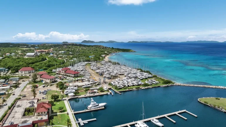
In 2003, commercial development once again placed HMS Nymph in the spotlight. Proposed land reclamation along the western harbour increased the likelihood that this historic shipwreck would be damaged by boats anchoring in the vicinity, and furthermore that sections of this shipwreck might be lost forever under landfill.
This spurred the need for a thorough, on-site evaluation of the site. In 2004, Michael Kent of H. Lavity Stoutt Community College contacted Dr. Mark Horton, head of the Department of Archaeology and Anthropology at the University of Bristol, to invite archaeological surveys of the shipwreck site. A team of both archaeologists and historians assembled by the author, and working under the auspices of the Department of Archaeology and Anthropology at the University of Bristol, travelled to Tortola.
Our purpose was to identify and assess the extent of structural and cultural remains, while examining effects of dredging and land reclamation. Between 18 June and 2 July 2005, underwater surveys of the western harbour collected data on submerged features running two square kilometres east along the breakwater and amassing a total of 200 in-water hours. Conditions along the west end of the harbour are varied, with visibility allowing a total perspective of between 1 and 4.5 metres. Defined sections of hard sand, silt, silt loam and clay loam were recognized within contour depths from 2.5 to 9 metres. These exposed layers are indicative of harbour dredging, revealing potential targets of undisturbed cultural layers through depth and soil formation.
The first site investigated was in approximately 2.5 metres of water and made up of a relatively intact section of lower hull structure with at least two major components lying off to one side and wholly disarticulated. The first component was a heavily worn floor fragment; a frame component identified by the cut limber passage similar to those identified on the coherent structure. A section of ten frame positions were exposed, and represent a small section of a much larger preserved hull. Frame components are positioned on a northwest, southeast heading and masked by a large ballast pile.
Ceiling planking was extremely worn and equally fragile demanding extreme care not to dislodge entire sections. What appears to be a disarticulated bottom plank was observed lying adjacent to the articulated keel component and close to an estimated in situ position. Further investigation yielded intact and in situ garboard strakes left in position when the disarticulated keel fragment was forcibly removed from between by a previous unknown disturbance.
Planks were attached to frames, primarily with spikes, although limited numbers of wooden trunnels were also identified. Several wood samples were taken from different frames to determine whether the same wood was utilized or different species. Planks appear pine-like at first glance in regards to both colour and grain.
The second component was a section of keel that included both discernable rabbets and a relatively intact scarf joint. This scarf was comparable to the dimensions recorded on the keel component observed on the intact structure, and likely represents the mate to this keel scarf. The section of keel bore a bevelled repair, incorporated into one cornered edge. The keel section had likely been recently removed by a boat anchor, due to its exposed, yet still preserved, state.
Artefacts located at the north position of the keel include a glass bottle, ceramics and the bowl of a ship’s compass. The second site, approximately 15 metres away, consists of at least six frame positions indicated by fastener patterns and a number of contiguous sacrificial planks. Planks exhibit small samples of associated animal hair and tar matrix—a mixture used to caulk the ship’s seams and designed to prevent shipboring organisms from consuming the hull planks.
These structural components lie very close to a dredged channel, an operation that undoubtedly dislodged what was once a section of articulated hull structure. Cultural remains protrude at a depth of 1.8 metres below main strata and are exposed to the northeast. There were a number of both bottom plank and eroded frame fragments located immediately down from and buried within the slope. Hull structure lies on a northeast, southwest heading. Planks were attached to frames almost entirely with wooden trunnels and a very limited number of iron spikes.

While the size of these various structural components would probably be applicable for a 300-ton vessel and hence HMS Nymph, the presence of the sacrificial planking would not be consistent with the historical evidence of her having been copper sheathed. Both frames and bottom planks appear to be oak while the sacrificial planking appears to be pine. An assemblage of red bricks, consisting of 14 individual members, was located. A rudder gudgeon, ship’s fasteners, shoe buckle, wooden chock, iron shackle, wrought iron hook, musket balls and iron ball shot were identified. A section of rope was also found.
Two additional sites were located, northwest of the first and second sites. The ballast site consists of two concentrations of stone ballast lying atop a hard sand layer at a depth of 2.4 metres. This pinnacle of undisturbed sand covers an area of approximately nine square metres and revealed what appeared to be an intact frame chock, and also a wooden sheave.
The sheave would have been originally positioned within a wooden rigging block to save friction and enable the running rigging. The steel wreck site lies on the east side of the pinnacle, described above. Sections of steel frame and riveted steel plates were located, protruding out of a hard-packed loam layer. A length of steel chain, including concreted engine components, was also located between the three- and five-metre strata layer. The ballast site requires further investigation, and could potentially reveal intact hull structure.
Certainly, both the ballast and steel wreck site illustrate the expanse of cultural remains located beneath Road Town Harbour, and a need to assess and define their origin and significance. Field investigations yielded a vast amount of information, documented through field drawings and captured with photographs and video. Furthermore, wood and environmental sample collection, through anatomical and chemical analyses, will hopefully provide us with a geographical origin for the ship’s structure. We continue to process our field data, and are waiting on the final report for recovered samples. Through these applications in archaeological science, we expect to advance our interpretation of site material and provide a more thorough assessment.
Analysis and Interpretation
Examination of material evidence from the 2005 field season does not corroborate with a 300-ton naval sloop of war. The structural remains suggest two shipwrecks, likely involved in trading. The first site contained exposed structure whose scantling was simply too small to be Nymph, but nonetheless proved to be an interesting and fairly intact lower hull.
The second site exhibited hull structure of appropriate dimensions, but the absence of copper sheathing does not support historical records that establish HMS Nymph was coppered at Plymouth in August 1782, shortly before her departure to the Caribbean. The timeline was likely in anticipation of duties within warmer waters. Coppering would prevent barnacle and weed growth, which caused reduction to ship’s speed while preventing damage to the timbers by Teredo navalis, a marine boring mollusc.
The artefact assemblage points to a date of mid-18th century. A prevalence of undecorated creamware, which includes plate fragments and a small bowl top, were identified and suggest a date of the 1760s. Fragmented glassware, which also included a bottleneck and base made of natural green glass, were identified on site. A n intact olive-green bottle with a pronounced pointed kick and unpolished pontil mark was also located.
Certain dangers exist for researchers in identifying solitary artefacts, especially in a harbour environment where general refuse and loss contribute to the archaeological record. Our dated assemblage was, therefore, based on artefacts located in direct context with structural remains.
It is the provenance of the remains, which will hopefully contribute to our identification of these shipwrecks. Shipping dramatically increased at harbours, such as Road Town, in response to the triangle trade. Enslaved Africans transported on English ships to North America and the Caribbean were purchased by wealthy landowners to maintain plantations. Human cargoes were easily replaced with sugar and cotton on Tortola during the 17th and 18th centuries, for shipment to ports such as Bristol, Liverpool and London.
Furthermore, the strategically situated harbour at Road Town experienced a growth spurt by the mid-18th century, when European ships were drawn to the island’s natural resources such as timber, fresh water and salt. It is therefore unsurprising that with this growth in shipping, the consequence of shipwrecks would be uncovered.
This project would not have been possible without a dedicated team and generous sponsors. Special thanks to Michael Kent for coordination, David Moore for structural analysis and Peter Holt for managing site data. Additional thanks to project team members David Antscherl, David Bouman and Helen Holt. Many individuals and companies donated services, time, equipment and money to the project. Christopher Juredin and his team from Commercial Dive Services, Photographer Armando Jenik from Underwater Production Services, Paul Hubbard from Rainbow Visions Underwater Photography, Royal BVI Yacht Club, TMM Yacht Charters, Horizon Yacht Charters, BVI National Parks Trust, Mr. Charles Consalvo from St. Thomas, USVI, Dr. Greg Herbert from Baltimore, Maryland, and Mr. Richard Dulik from Great Falls, Virginia.
Ms. Kimberly Monk, a maritime archaeologist, is coordinator of the MA in Maritime Archaeology and History and lecturer for postgraduate and undergraduate units on maritime archaeology at the University of Bristol.